| I | INTRODUCTION |
Arctic, large, cold area of Earth around the North
Pole. The Arctic includes the Arctic Ocean, many islands, and parts of the
mainlands of North America, Asia, and Europe. The Arctic region is particularly
sensitive to global warming and other climate change, and it has a major
influence on climate and weather on the rest of the planet.
Scientists define the Arctic in a number of
ways. Geographically, the Arctic is the area north of the Arctic Circle
(latitude 66°30′ north) where 24 hours of daylight and 24 hours of night occur
at least once a year. In terms of climate, the Arctic may be defined as the
region north of the 10°C (50°F) summer isotherm. The summer isotherm is a line
on a map drawn through locations with an average annual temperature of 0°C
(32°F) or less and a mean temperature for the warmest summer month of 10°C
(50°F). In addition, the Arctic may be defined as the region north of the tree
line, the point beyond which trees do not grow. The summer isotherm and the tree
line enclose roughly the same territory, which is somewhat larger than the
region bounded by the Arctic Circle. The Arctic is also defined as the region
where permafrost remains continuously frozen throughout the year. Oceanographers
sometimes define the Arctic as the portion of the northern oceans that is
covered with ice for at least part of the year.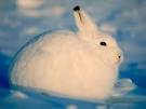
The largest Arctic land areas are in Canada,
Russia (including Siberia), Greenland (Kalaallit Nunaat), Scandinavia (in parts
of northern Norway, Sweden, and Finland), Iceland, Alaska, and Svalbard and
other islands.
The name Arctic derives from Greek
arktos “bear,” referring to the constellation of the Great Bear (Ursa
Major), which circles the North Star in the night sky.
| II | THE NATURAL ENVIRONMENT |
Unlike Antarctica, an ice-covered continental
plateau surrounded by oceans, the Arctic has a central ocean almost enclosed by
land. One large gap exists between Greenland and Scandinavia, and much smaller
breaks are among the Canadian Arctic Islands and at the Bering Strait, which
separates Alaska and Siberia.
The principal geological elements of the
Arctic include parts of three ancient landmasses, composed predominantly of
granite and gneiss, which are called shields—the Baltic-Scandinavian-Russian
Shield, the Angara Shield or Siberian Platform (in north central Siberia), and
the Canadian Shield (including all the Canadian Arctic except for the Queen
Elizabeth Islands). Several regions, such as most of Greenland, are permanently
ice covered, and extensive coastal plains are along much of northern Siberia,
parts of the northwestern mainland and islands of Canada, and the North Slope of
Alaska. Mountain ranges are in the eastern Arctic region of Canada (notably on
Baffin Island), in Yukon Territory, in northern Alaska, in coastal Greenland, in
Iceland, and in northeastern Siberia.
| A | Ocean, Seas, and Coastlines |
The largest body of water in the Arctic is
the Arctic Ocean, which connects with the North Pacific Ocean and North Atlantic
Ocean. The Arctic Ocean includes the Barents Sea, the Beaufort Sea, the
Greenland Sea, the Kara Sea, the Chukchi Sea, the East Siberian Sea, and the
Laptev Sea, and connects to the Bering Sea and the North Sea. About 45,390 km
(28,142 mi) of coastline border the Arctic Ocean.
Arctic sea ice has a major impact on
global and local climate. Sea ice is sea water that freezes in winter and may
partially melt in summer. As sea ice forms and ages, it slowly turns into fresh
water as salt is expelled downward. Ocean water under sea ice has a higher
concentration of salt and is denser than surrounding water. The denser salty
water sinks, creating a giant circulation pattern that draws warm water near the
surface toward the Arctic while colder, denser water flows toward the tropics at
a deeper level. When sea ice melts, it creates a layer of less-dense fresh water
at the surface of the ocean.
The white surface of the sea ice reflects
sunlight and has a cooling effect, in contrast to dark open water that absorbs
heat. Sea ice also blocks evaporation off the surface of the ocean—reduced sea
ice can result in more intense Arctic storms from increased water vapor in the
atmosphere. In addition, sea ice along coastal areas protects land areas from
erosion by large waves caused by wind and storms.
Glaciers and ice sheets that reach the
edge of the sea create icebergs, giant blocks of freshwater ice that break away
and float in the ocean. The melting of icebergs and glaciers into the ocean can
raise sea levels. Adding large amounts of less-dense fresh water can also change
the flow of ocean currents and affect temperatures of water and air.
| B | Rivers and Lakes |
Low precipitation is characteristic of the
Arctic, so large and elaborate river and lake systems are rare. In many places,
however, permafrost (permanently frozen subsoil) restricts the downward drainage
of meltwater from snow, and the water accumulates on the surface as shallow
lakes, ponds, and marshes. In addition, rivers from more humid regions flow
seaward across the dry Arctic terrain. Several large rivers are in the Russian
Arctic, and the Mackenzie and Yukon rivers are in North America.
| C | Climate |
Winter in the Arctic is long and cold, and
summer is short and cool. The Arctic Circle marks the border of a zone in which
the sun never rises during at least one day in winter and never sets during at
least one day in summer. The number of days when the sun is or is not visible
during the entire day increases toward the north. Latitude, which determines the
length of daylight, influences climate, but nearby areas contrast sharply. For
instance, on the Greenland ice cap average midwinter temperatures are -33°C
(-27°F), whereas adjacent coastal settlements, whose climates are moderated by
the relatively warm ocean, typically have a mean temperature of -7°C (19°F) in
the same period. The North Pole is not the coldest spot in the Arctic, because
its climate is moderated by the ocean. Oymyakon, in northeastern Siberia, holds
the record low temperature of -68°C (-90°F). The coldest recorded temperature
for North America is -65°C (-85°F), at Snag, in Yukon Territory. The
characteristically low precipitation averages less than 250 mm (10 in) per year,
the moisture being received in almost all locations.
| D | Magnetic Pole |
Earth’s magnetic north pole affects the
Arctic. The lines of force in Earth’s magnetic field converge around the pole,
allowing charged particles trapped in Earth’s magnetosphere to strike the
atmosphere over the Arctic. The particles cause auroras and can result in
magnetic storms that affect communications worldwide.
| E | Vegetation and Wildlife |
The Arctic is not a frozen desert devoid of
life on land or sea, even during the cold, dark winter months. Spring brings a
phenomenal resurgence of plant and animal life. Low temperatures are not always
the critical element—moisture, the type of soil, and available solar energy are
also extremely important. Some animals adapt well to Arctic conditions; for
instance, a number of species of mammals and birds carry additional insulation,
such as fat, in cold months. Arctic summers with extended daylight attract
breeding birds and other animals. Warming temperatures in recent decades have
allowed some plants and animals that lived south of the Arctic to expand their
ranges northward. However, pollution and climate change are also having negative
impacts on Arctic wildlife.
The Arctic has more than 400 species of
flowering plants. The vast stretches of treeless tundra that cover the plains
and coastal regions consist of low creeping shrubs, grasses, thick growths of
lichens and mosses, and herbs and sedges.
Abundant animal life inhabits the Arctic,
both on land and in the sea. Arctic land mammals include polar bears, arctic
foxes, ermines, martens, arctic wolves, wolverines, caribou, reindeer
(domesticated caribou), musk ox, lemmings, and arctic hares. Marine mammals
include seals, walruses, and many species of whales, including narwhals and
belugas.
Birds are plentiful throughout the Arctic.
The guillemot and little auk nest by the thousands along cliffs. Ravens, snow
buntings, and sandpipers have been seen in the remotest northern land regions,
as have the snowy owl and the gyrfalcon. Various species of gull, including the
jaeger, also range far to the north. The Arctic tern spends the northern summer
in the Arctic then flies to the Antarctic to spend the southern summer there.
Among other characteristic Arctic birds are the eider duck, teal, loon, petrel,
puffin, and ptarmigan.
Insects, found in the Arctic wherever
vegetation exists, include bees, wasps, flies, butterflies, moths, beetles, and
grasshoppers. Mosquitoes, black flies, and midges are common in tundra regions,
and feed on the blood of warm-blooded animals.
Coastal waters are relatively rich in such
fish as cod, flatfish, halibut, salmon, and trout. A large variety of
invertebrates have been observed in Arctic seas.
| F | Mineral Resources |
Large deposits of several important
minerals occur in the Arctic. Among them are petroleum, natural gas, iron ore,
nickel, lead, zinc, coal, uranium, tin, diamonds, gold, and cryolite.
| G | Pollution |
Although the Arctic seems remote from
industrialized areas of the Northern Hemisphere, winds and ocean currents carry
pollutants to the far north where they can become concentrated, contaminating
the environment and entering the food chain. Other pollutants may be carried to
the Arctic in the droppings of migrating birds. High levels of PCBs, dioxins,
and mercury have been detected in the fat of marine mammals and in fish in the
Arctic. These pollutants can pose a health danger to indigenous peoples in the
region who eat seals and whales. Smoglike haze from distant industrial air
pollution sometimes forms in the polar region.
Scientists have also found a major
thinning of the ozone layer high in the atmosphere over the Arctic similar to
the ozone hole found over the Antarctic. The ozone layer of the upper
stratosphere is damaged by chemical reactions with chlorofluorocarbons and other
chemicals. These reactions are enhanced by sunlight, winds, and cold
temperatures. High-energy particles from the Sun during solar storms can also
damage the ozone layer.
| III | THE PEOPLE |
The earliest known evidence of humans in the
Arctic comes from a site in Russia called Mamontovaya Kurya. In 2001 a team of
archaeologists announced finding stone tools and a mammoth tusk with cut marks.
The artifacts were dated to about 40,000 years ago during the ice ages.
Scientists have not yet determined if the objects were made by modern humans or
by Neandertals.
The first peoples to reach the Americas may
have passed through the Arctic region on foot over a land bridge between Siberia
and Alaska, or they may have followed a northern coastal route from Asia to
North America using boats, arriving perhaps as early as 20,000 years ago. A few
researchers have suggested that some groups of people could have come to the
Americas from Europe by crossing the Atlantic Ocean along the edge of giant ice
sheets that bridged the land and ocean between the continents during the ice
ages.
Long before modern Europeans reached the
Arctic, much of the region had a scattered population, with Iceland a notable
exception. The indigenous peoples came from many ethnic groups, using various
languages, but it is believed most migrated from Asia over a span of thousands
of years. The Inuit eventually reached the Atlantic Ocean in eastern Greenland,
and the Saami reached Norway.
About 20 national groups exist today in the
Arctic areas of Russia. These include the Komi, or Zyrian, occupying Arctic
areas of European Russia; the Yakut, living mainly in the Lena River Basin; the
Tungus, inhabiting a large region east of the Yenisey River; the Yukaghir,
dwelling chiefly between the Yana and Indigirka rivers; and the Chukchi,
inhabiting extreme northeastern Siberia. The Arctic areas of North America
contain three main ethnic groups—the Aleut, the Yuit, and the Inuit—who live in
northern Canada and in Alaska. The Aleut mostly inhabit the region of the Bering
Sea; the Native Americans generally occupy grasslands; and the Inuit live mainly
in northern Alaska, northern Canada, and coastal areas of Greenland. Canada
created the separate administrative region of Nunavut in 1999 to give the local
Inuit population more control over their own government and cultural
development.
All the indigenous residents of the Arctic
originally depended entirely on hunting or fishing, or both, and employed
natural materials for their clothing, tools, homes, and vehicles. Articles were
well designed and skillfully made, and some were artistically decorated.
Well-known are the Inuit kayak, parka, and harpoon. The indigenous peoples in
the Arctic region today have adopted some modern technology such as guns and
snowmobiles, but also retain rights to subsistence hunting of marine mammals and
other traditional practices.
The Arctic has also been settled by persons
from more southern areas. Norwegians and Russians reached the seacoast of
northern Europe about 1,100 years ago, when the Norse were also settling
Iceland. In recent times, scientists, miners, and missionaries have established
communities in the Arctic.
There are no large cities in the Arctic
areas of Alaska, Canada, and Greenland, the largest cities generally having
fewer than 10,000 inhabitants. The Arctic regions of Scandinavia and Russia,
however, contain several communities of considerable size, such as Murmansk and
Noril’sk, in Russia, and Tromsø, in Norway. Reykjavík, Iceland, is an important
urban center.
| IV | PATTERNS OF ECONOMIC DEVELOPMENT |
Economic activity in most of the Arctic is
limited to obtaining and processing natural resources, especially fish and
minerals.
| A | Agriculture |
The Arctic environment is generally
unfavorable to the production of food by cultivation or animal husbandry.
Reindeer herding, however, is important in northern Scandinavia and Russia and
to a lesser extent in the Arctic areas of Alaska, Canada, and Greenland. Sheep
are raised in southwestern Greenland and in Iceland. Dairy farming to supply
nearby communities is widespread; almost 1 million cattle are in northern Russia
alone.
| B | Fishing |
Fish from rivers and lakes are important
for the diet of people living in the Arctic. Russia has highly developed river
fisheries serving the local population as well as customers in distant cities.
The Arctic Ocean is among the world’s most important fishing grounds, and many
countries send fishing boats to its waters. Large amounts of cod and shrimp are
caught off western Greenland. Overfishing has become a problem in some regions,
however.
| C | Mining |
The recovery of minerals is an important
industry in several parts of the Arctic regions. In Russia, nickel, iron ore,
and apatite are produced on the Kola Peninsula, and diamonds are mined in the
Lena River valley. Other major mineral products in the Russian Arctic include
gold, tin, coal, mica, and tungsten. Sweden has produced iron ore at Kiruna and
elsewhere north of the Arctic Circle since about 1900, and Norway has an
important iron-ore mine on its northern coast at Kirkenes. Lead, zinc, and
molybdenum are produced in Greenland, which formerly recovered much cryolite at
Ivigtut. Large coal mines are on Spitsbergen, one of the islands of Svalbard.
Mineral products of the Canadian Arctic include uranium, copper, nickel, lead,
zinc, asbestos, iron ore, diamonds, petroleum, and natural gas.
Major interest has focused on petroleum
and natural gas deposits in the Arctic, particularly as milder temperatures and
reduced ice resulting from global warming may make locating and extracting such
resources easier in the future. Large-scale production of petroleum on the
Arctic North Slope of Alaska began in 1977. A proposal in 1987 by the
administration of Ronald Reagan to open up the Arctic National Wildlife Refuge
to oil development met with strong opposition from various environmental
organizations. Russia has made claims to areas of the seabed near the North Pole
that may hold 10 billion barrels of petroleum. Norway has announced plans to
drill for natural gas in the Barents Sea.
| D | Manufacturing |
The North American Arctic is not of major
manufacturing importance, except for raw-material processing. Costs of labor and
transportation are too high for general manufacturing. Russia, however, has
several important industrial areas in the north. These include the Kola
Peninsula, the Pechora River valley, the Yenisey River valley, and the Lena
River valley near Yakutsk. Raw materials are processed in the Canadian Arctic,
and Greenland and Iceland have a variety of small-scale manufacturing
industries.
| E | Transportation |
Land and water transportation in the
Arctic are hindered by year-round or seasonal obstruction by ice. Few roads
serve the area, although some important arteries are in mainland Canada,
northern Russia, and northern parts of Norway and Sweden. Coastal shipping is
significant in several regions of the Arctic, notably in Russia, Scandinavia,
Alaska, and Canada. Icebreakers clear shipping lanes in winter. Russia has a
good river navigation system in summer. Air transportation is of great
importance. Airports serve several communities, and “bush” airlines link
isolated communities and mining operations with larger centers.
| V | CLIMATE CHANGE IN THE ARCTIC |
The Arctic is being severely affected by
global warming, according to a scientific study released in 2004. The
four-year-long study, known as the Arctic Climate Impact Assessment, was
produced by the Arctic Council, consisting of the eight countries that ring the
Arctic Ocean along with scientists and members of indigenous groups living in
the Arctic. The study found that the average temperature in the Arctic rose
nearly 1°C (2°F), almost twice the rate as the rest of the world, in the past
few decades. The average winter temperature rose nearly 2°C (4°F), while parts
of Russia and Alaska saw average winter temperatures rise 8°C (11°F) since the
1970s.
The study attributed the rising temperatures
to increased emissions of carbon dioxide and other greenhouse gases, mainly due
to the burning of fossil fuels throughout the world. The study found that as a
result of the warming there was widespread melting of glaciers and sea ice and a
shortening of the snow season. The report found that the average annual extent
of sea ice in the Arctic had decreased by nearly 1 million sq km (386,000 sq mi)
since 1974, an area nearly equal to that of Texas and New Mexico. The melting
was expected to worsen global warming by increasing the amount of dark area that
absorbs sunlight and thus warms the planet.
The study warned that a number of problems
could result from the increased warming. Glacial and snow melt and increased
river runoff would add more fresh water to the oceans, potentially affecting
ocean circulation such as the Gulf Stream, which is principally responsible for
Europe’s moderate weather (see Ocean and Oceanography). Reductions in the
amount of sea ice were also expected to shrink habitat for polar bears, seals,
some seabirds, and other species, while climate change could also affect food
sources, migratory routes, and breeding grounds for caribou and reindeer
herds.
Studies published since the 2004 report have
found evidence that Arctic Ocean sea ice is thinning and melting much faster
than previous climate models predicted. By one estimate, the Arctic Ocean could
be ice-free in summer by 2030, with reduced ice cover in winter. In the summer
of 2007 the Northwest Passage from the Atlantic Ocean to the Pacific Ocean was
open for the first time as a result of reduced sea ice. Unusually warm summer
temperatures were also recorded on land in some areas. Continued warming could
open sea lanes year-round so that ships could transport cargo and more natural
resources. Less sea ice could also enable petroleum companies to increase
offshore drilling for oil.
The thawing of permafrost may release large
quantities of methane gas into the atmosphere. Methane is about 23 times
stronger than carbon dioxide as a greenhouse gas. As the frozen ground in the
Arctic melts, it forms ponds and lakes where methane-producing bacteria begin to
feed on carbon from ancient organic material in the soil. Another effect of
melting permafrost is damage to houses and roads, as well as to pipelines and
other facilities built to extract and transport natural resources. Ground that
was once stable can sink and crack as the frozen soil thaws.
| VI | EXPLORATION OF THE ARCTIC |
The Greeks of the 4th century bc were aware of the Arctic, parts of
which had already been settled by Inuit and Native Americans. Early in the 9th
century ad, Irish monks
established a colony in Iceland. Vikings, or Norsemen, from Scandinavia reached
there later in the century. About 982 the Norse explorer Erik the Red sighted
and named Greenland. During the next four centuries, Norsemen probably visited
the Canadian Arctic.
Subsequent Arctic exploration was largely
motivated by the European need for sea routes to East Asia—the Northeast Passage
along northern Asia and the Northwest Passage through the Arctic islands of
North America. In 1553 the English navigator Sir Hugh Willoughby initiated the
search for the Northeast Passage. His companion, Richard Chancellor, reached the
site of modern Arkhangel’sk, on the White Sea, thus opening a new route to
commerce.
The search for the Northwest Passage began
in earnest when English explorer Sir Martin Frobisher reached the Canadian
Arctic in 1576. In 1587 John Davis sailed through part of what became known as
Davis Strait, between Greenland and Baffin Island. In 1610 Henry Hudson sighted
the bay that was later named for him; it was explored from 1612 to 1613 by Sir
Thomas Button from Wales. English navigator William Baffin explored what came to
be called Baffin Bay in 1616.
Russian exploration of the coast of the
Siberian Arctic was promoted by Tsar Peter the Great in the early 18th century.
He employed Danish navigator Vitus Jonassen Bering, who in 1728 discovered the
strait separating Siberia and Alaska that bears his name.
As part of a renewed effort to find the
Northwest Passage, the British government in 1818 organized the first of several
Arctic explorations under Sir William Edward Parry, who in 1819 reached Melville
Island in the Canadian Arctic. In 1845 Sir John Franklin led a British
expedition toward the Bering Strait from Lancaster Sound, an arm of Baffin Bay.
After his two ships were trapped by ice in 1846, the crews abandoned the ships,
and all 130 men (including Franklin) perished. Their disappearance led to many
search parties, beginning in 1848. Adolf Erik Nordenskjöld of Sweden, aboard the
Vega, from 1878 to 1879 became the first to complete the Northeast
Passage.
The first official Arctic expedition from
the United States, in 1881 and 1882, was part of the first International Polar
Year. Under the command of Lieutenant Adolphus W. Greely, it was based at Lady
Franklin Bay, on Ellesmere Island, and made observations on magnetic and
meteorological phenomena. In 1884, when relief vessels finally arrived, 17
members of the expedition had perished from cold and starvation.
The Greenland ice cap was first crossed in
1888 by Norwegian explorer Fridtjof Nansen. In September 1893 Nansen attempted
to cross the North Pole in the ship Fram, which entered the pack
ice near the New Siberian Islands. The vessel attained latitude 86°14’ north,
just short of the 90° mark of the North Pole, in August 1896.
Between 1886 and 1909 the American explorer
Robert Edwin Peary headed several expeditions to the Arctic by way of Baffin
Bay. He reached Cape Morris Jesup (on Greenland), the northernmost land point in
the Arctic, in 1900. On April 21, 1906, during an attempt to reach the North
Pole, he attained latitude 87°6’ north. On April 6, 1909, he finally reached the
North Pole by dogsled over pack ice from Grant Land in northern Ellesmere
Island. Some controversy continues to surround his claim to have reached the
Pole. The first voyage by ship through the Northwest Passage was accomplished
from 1903 to 1906 by the Norwegian explorer Roald Amundsen.
In 1906 Canadian-born American
anthropologist Vilhjalmur Stefansson lived with the Inuit near the Mackenzie
River delta. Between 1908 and 1912 Stefansson and Rudolph Anderson traveled in
the Coronation Gulf-Victoria Island area, also to study the Inuit. From 1913 to
1918 Stefansson commanded the Canadian Arctic Expedition, during which new land
was discovered in the Arctic Archipelago.
On May 9, 1926, American explorer Richard E.
Byrd, along with the aviator Floyd Bennett, may have reached the North Pole by
airplane, although this fact has been disputed. A few days later Amundsen,
Lincoln Ellsworth, and Umberto Nobile completed a flight of more than 70 hours
in the dirigible Norge, from Spitsbergen, Norway, across the North Pole
to Alaska, about 5,460 km (about 3,390 mi); and in 1928 Australian explorer Sir
George Wilkins and his pilot, Carl Benjamin Eielson, flew from Point Barrow,
Alaska, to Spitsbergen.
The Union of Soviet Socialist Republics
(USSR) established the Northern Sea Route Administration in 1932 to open
commercial shipping through the Northeast Passage and to develop Siberian
resources. In 1937 four Soviet scientists, led by I. D. Papanin, drifted for
nine months on NP 1, a small ice floe, studying the ocean, and they subsequently
set up temporary scientific stations on the drifting ice. By 1981 the USSR had
established about 26 such stations and had also made many briefer landings on
the Arctic Ocean ice for scientific purposes. During the summer of 1938, Soviet
pilots V. P. Chkalov and M. M. Gromov made nonstop flights over the North Pole,
to Vancouver, Washington, and to San Jacinto, California, in single-engine
aircraft.
During World War II (1939-1945), several air
bases and meteorological stations were established in Alaska, the Canadian
Arctic, and Greenland, and in 1947 a scientific station was founded at Point
Barrow, Alaska. In 1951 the U.S. Navy undertook Project Ski Jump in the Beaufort
Sea, making many sea-ice landings. The first U.S. station on drifting ice was
established early in 1952 by Joseph O. Fletcher.
Travel under the ice, long foreseen by
Stefansson and Wilkins, became a reality in 1958, when the nuclear-powered USS
Nautilus became the first submarine to traverse the Arctic Ocean. It went
from the Bering Strait to Iceland via the North Pole in four days. Scientific
activity in the Arctic increased greatly during the International Geophysical
Year (IGY) from July 1957 to December 1958. The program involved several
nations, which together operated more than 300 stations.
By the late 1970s, traditional exploration
had been largely replaced by systematic data gathering and scientific research.
Access had been greatly improved by airplane, submarine, icebreaker, and new
overland transportation methods, and Earth satellites and automatic instruments
had taken over much of the task of routine information collecting. The
centennial of the Vega voyage of 1878 to 1879 was marked by a major
research program by the Swedish icebreaker Ymer and an international
scientific team working between the Barents Sea and northeastern Greenland. In
the early 1980s, an international team of scientists pursued a long-term study
of the Greenland ice cap by analyzing ice cores obtained by drilling from the
surface to depths of about 2,040 m (about 6,690 ft).
Modern climate change has focused new
attention on ancient climates in the Arctic region. In addition to ice cores
from Greenland that date back thousands of years, scientists have looked for
fossils of plants and animals that indicate what the climate was like in the
Arctic millions of years ago. Because plate tectonics have shifted land masses
over the eons, many of the oldest fossils in the Arctic represent animals that
lived much further south before their remains were carried north. However, the
northern continents were roughly in their modern positions by the Cretaceous
Period, which lasted from about 145 to 65 million years ago. Scientists
discovered fossils of dinosaurs in the North Slope region in Alaska in the 1980s
and in the Arctic regions of Canada and Siberia in the 1990s. Dinosaurs that
lived in the Arctic must have experienced periods without sunlight and
relatively cold temperatures, although much milder than today and without ice
caps.
Fossils of plants and animals that lived in
the Arctic after the dinosaurs went extinct are also important sources of
information. Of particular interest are fossils from the Eocene Epoch, which
lasted from 56 to 34 million years ago. During the Eocene high levels of the
greenhouse gas carbon dioxide made Earth much warmer than today. In 1986, on
Axel Heiberg Island in the Canadian Arctic, the largest fossil forest yet found
in the Arctic was dated at about 45 million years old, raising interesting
questions about how plants adapted to changing environmental conditions there in
the geological past. In 2004 the Arctic Coring Expedition (ACEX) retrieved a
core of sediment from the Arctic seafloor that dated as far back as 40 million
years, providing a long record of marine organisms from near the North Pole.
Major scientific research projects to study
modern changes in the Arctic include the International Polar Year (IPY)
2007/2008, which runs from March 2007 to March 2009. The IPY involves thousands
of scientists from more than 60 nations in more than 200 projects focused on the
Arctic and the Antarctic. Topics of study include biology, geology, climatology,
meteorology, oceanography, and geophysics. Also ongoing is the Arctic Ocean
Diversity (ArcOD) Census of Marine Life. The ArcOD is part of the international
Census of Marine Life (CoML), a ten-year international initiative begun in 2000
to study life in the oceans. Warming in the Arctic could cause major changes in
sea life and threaten some species with extinction.
No comments:
Post a Comment